Day 4 Camino Portugués Tomar to Ansiao

If the weather had been normal Day 4 on the Camino Portugués would have been fine, more challenging than the first three days but doable.  With record breaking temperatures for April, approaching 40 degrees, it was very hard.

The good news is that the team managed to stick together with Robina and Christine both pushing the envelope in terms of there previous off-road experience.
The route was just shy of 50 kms long with around 900m of climb, the hardest day so far.  Riding time was around 4.30 mins.

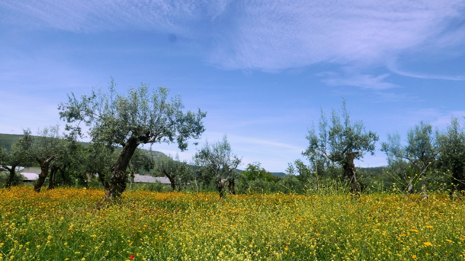
There was an interesting mix of road and off-road cycling with roads totally empty.  Although there were some short off-road climbs, the big pass, just after Alvaiázera, was completed entirely on asphalt.  Consequently although there was some pushing it didn't amount to much.
The first part of the first leg, a narrow rock strewn stretch of single track above a river wasn't the perfect start and confidence in my navigation took a hit. Things got better when the route widened into a gravelly track before emerging onto a road.

The next leg followed the road from hilltop village to hilltop village with the route clearly designed to make sure everyone got a share of the Camino action.  We were now following a route which had little in common with my GPS but the signs were excellent. Apart from occasional stretches of cobbles the surface was fast and comfortable.
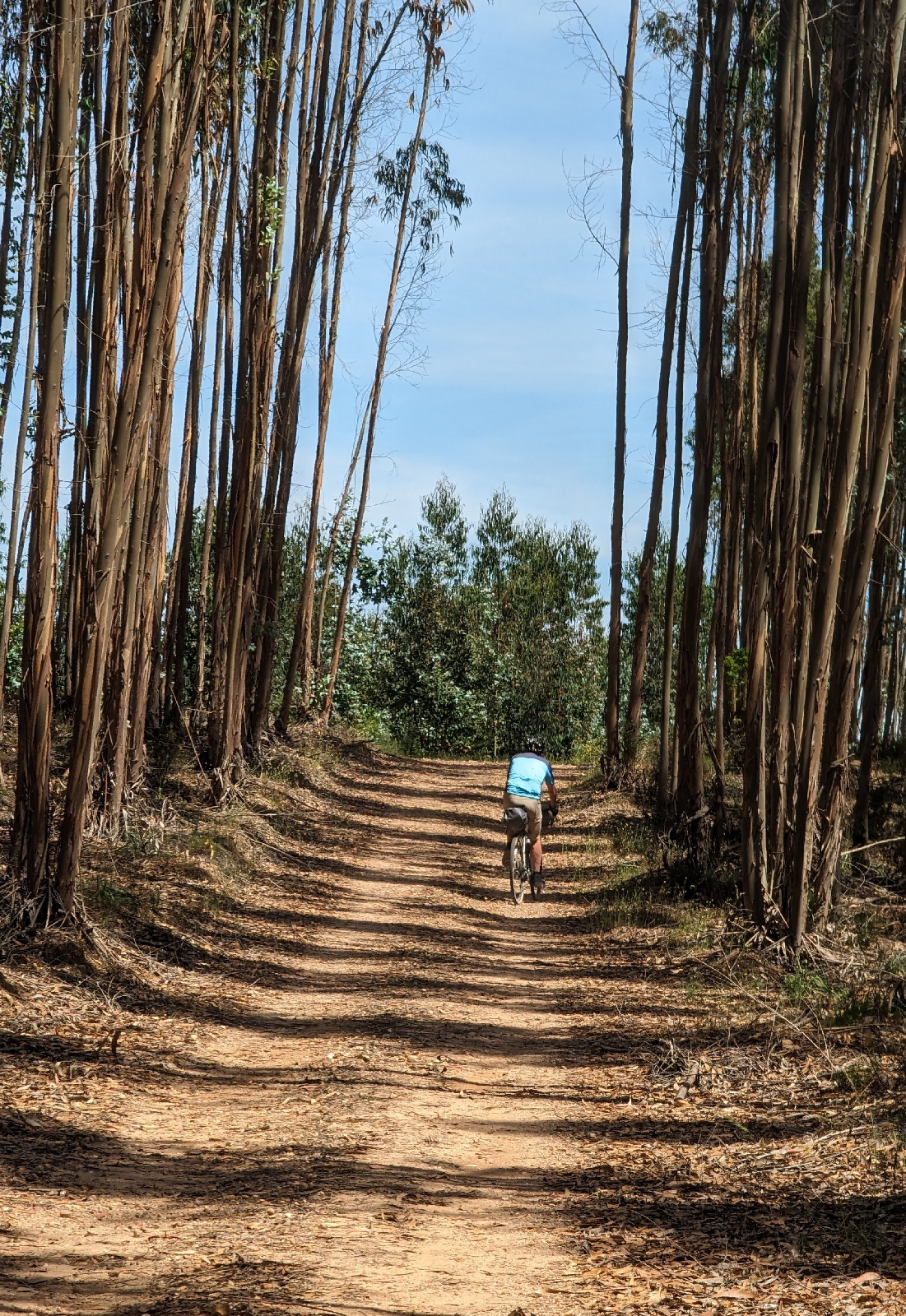
Leaving the road just north of Ceras the Camino split into two.  The anticipated option climbed a near vertical wall of loose soil and gravel, which the information board said could be challenging (to walkers) while the longer alternative took us through a nicely scented eucalyptus forest to Areias.  We chose the Areias option, most of which was off-road until we finally emerged into some sustained asphalt at the junction with the main E110.

From the E110 we headed north along an empty road to Cortica where, instead of doing the obvious thing and continuing to Alvaiázera, it turned right and followed a tiny road, usually cobbled with walls either side, through a series of half empty small  villages. 

We stopped at Alvaiázera for an excellent lunch (9€ each) before tackling the day's big climb which thankfully followed a road. Over the pass and anticipating an easy run down to Ansiao there was again a sting in the tail with the route vering off into a combination of steep and treacherous gravel tracks.  The only compensation was that the route headed predominantly downhill.  
Ansiao is a staging post for pilgrims but doesn't appear to have much going for it  apart from that.  We're staying in the municipal auberge, brand new and comfortable.  My only complaint was that, after a very hot day, the shower had only one temperature, very hot.


Day 3 Camino Portugués Santarém to Tomar


Day 3 makes the transition from a landscape dominated by the River Tagus and its huge and intensively farmed flood plain, to something much more mountainous and, from a cycling perspective, challenging.
First the metrics. Theoretically today's route was 62 km with climbs and descents of 330m. Because I missed a couple of turns, and we had to retrace our steps, we ended up cycling 72 km with a riding time of just under 5 hours.
Despite their electric MTBs, Christine and Robina are very cautious about "mixed surface" cycling. The bikes are horribly heavy and a fall could be serious. Today we came up with alternative routes to avoid what looked like the dodgy bits. In practice this meant that they stuck to the roads which are very quiet but occasionally cobbled.

We split the route into three sections: the first to Azinhaga,  mid morning coffee destination; the second to Vila Nova da Barquinha, where we stopped for lunch; and the third, the final section into Tomar. Golegã looked the nicest place, with the biggest choice of cafes and restaurants but it would have been too late to stop there for coffee and too early for lunch. 
The first leg followed the River Tagus although you didn't get to see it that much. Constant irrigation and heavy agricultural traffic meant that the path was rutted in places but I think Robina and Christine could have got through. The route was mixed, going from shady wooded lanes into huge open fields growing peas, potatoes, and maize. It's a long leg and coffee didn't come a moment too soon.
We parted company, after 7 km of cobbles, at Golegã, and Mike and I headed into what we thought was an off-road stretch with Christine and Robina sticking with the road. We should have stayed together because it was a great surface all the way to Vila Nova da Barquinha.

The only thing Vila Nova da Barquinha had going for it was lunch. Christine found a place full of locals and we were rewarded with something very cheap, wholesome but not exactly vegetarian.
The last leg was tough with a lot of climbing along a gravely surface through a eucalyptus forest. I enjoyed it but it was very hot and for the first time on the trip we had to do some sustained pushing. At the top of the pass there was a handily placed water hydrant which we shared with a couple of friendly pilgrims from Slovenia. So while we should have stuck together for the first two legs it was a good job Christine and Robina stayed on the road on the third.
Tomar is the biggest place we've stayed at so far, the magnificent Templar castle overlooking a town full of bars and restaurants. We finished the day with another amazingly priced dinner consisting of various types of crustaceans and lovely slightly fizzy Portugués white wine.


Day 2 Villa Franca de Xira to Santarém


Today's ride was a hot slog on mainly gravel tracks through the flat river plain north east to Santarém. Walking this stretch must be soul destroying, a huge flat agricultural landscape very reminiscent of the Fens in the east of England.
First the metrics. The route was 54 kms with 140 metres of climb and 51 metres of descent. All the climb was at the end involving a very steep pull up to the town of Santarém. Moving time was just under 4 hours.

The big lesson for today was not taking the route too seriously. If we had followed the Camino we would have had to navigate three railway stations and after yesterday's experience with the lifts this was something we wanted to avoid. It did involve a bit more road cycling that might otherwise have been the case, including a 4 km stretch with bumper to bumper lorries, but after we had made it to Azambuja the railway line was at last behind us. After that we tended to be very close to the route (yards away) but not necessarily on it and to be honest even the pilgrims were involved in route rationalisation.
After Azambuja the landscape became seriously agricultural - super productive with nearly all the fields irrigated. We think the main crop was tomatoes, at a very early stage but fields and fields of them. In the middle of this ocean of agriculture was Vallada, a small village on the side of the River Tejo and clearly a pilgrim staging point. We stopped there for lunch and given the number of restaurants and cafes we chose well. It's a national holiday today and the locals were out on the beach while we enjoyed a salad and what we think were local shrimps.
Vallada was the perfect place to stop as it left just 20 kms (more fields of tomatoes) before Santarém, some shade and a beer.
We're still getting into the swing of things and spent the best part of an hour this morning waiting for a replacement charger for Robina's bike. By the time we had consumed our beers, showered and washed our clothes the "golden hour" was well underway. We still managed a tour of the Santarém ramparts at the end of the prominotory facing east with amazing views of the River Tejo both to the north and south. I suspect we have a bit more agriculture scenery to cross before finally escaping the river and heading into the mountains.


Day 1 Camino Portugués- Lisbon to Vila Franca de Xira


Day 1 was much better than I was anticipating. There was a lot of the urban sprawl you would expect around a capital city: the mix of new development and the dereliction associated with property waiting to be built; but there was also lots of quiet cycling through wide open countryside.

Day 1, starting at the bike hire shop and finishing at Vila Franca de Xira, involved 45 Kms of cycling with just 150m of climb and descent. According to Strava our average moving speed was just under 12km per hour, which makes sense give how much of the route was off-road. There was only one hill but it was a horrible one, just on the other side of an underpass south of Vialonga, and too steep to cycle with fully laden unpowered bikes. Christine and Robina sailed up it. The weather by way has been warm, verging on hot, we're experiencing at heat wave in April.

There was only one section of sustained mixed traffic cycling, a nasty busy road just to the east of Sobralinho, and apart from that the route sharing was with people including some pilgrims. There was a surprising amount of rough trail which would have been treacherous if things weren't so dry.

Some important lessons from the first day.

The decision, forced on me by majority rule, to go to Vila Franca de Xira rather than on to Santarém was the right one. Vila Franca de Xira has nothing to commend it but trying to get all the way to Santarém would have been a big mistake. If you're hiring bikes they take a bit of getting used to and there's always some fiddling about at the bike hire shop. All of this takes time so not being too ambitious on the first day was the right thing to do.
Secondly, ignore the Camino when you're cycling out of Lisbon. Lisbon is getting more cycle friendly but it's still an intimidating place to start a trip from. Finding your way out from the cathedral, where the Camino starts, involves lots of hills and a complex one-way system. The simpler way out is the harbour side cycle way which joins the Camino about 5km to the east of the town.

Thirdly it's important to remember that the Camino was designed for walkers not cyclists. It's OK for the route to take walkers the wrong way down a one way street but that's not always so good when you're on a bike. My route already missed the worst of the offending sections but ignoring the waymarks is sometimes necessary.
Highlights of today were the beautiful wild flowers, hedge high, all purples and yellows on the stretch between Bobadela and Vialonga. Also, for Christine and the other 2 carnivores, the unexpectedly good lunch in a simple village cafe: oxtail stew with proper home made chips and a bit of salad. €10 with fizzy water and coffee. I made do with a cheesy omelette and the same chips, but so far Portugal isn't great for vegetarians.
The biggest challenge of the day was getting the bikes through the station at Alverca do Ribatejo, to get from one side of the railway line to other. Getting massive electric MTBs in the lifts was tough to say the least.

Day 0 Camino Portuguese


Tomorrow we set off on a 28 day tour of Northern Portugal and a bit of Northwest Spain.  The plan is to cycle the Camino Portuguese Central up to Porto and then onto Santiago del Compestalla, turning round and then heading and back to Porto along the coastal variant of the Camino.  After that we'll return along the coast all the way back to Lisbon (taking the Eurovelo along a route I've done before so can vouch for).

I see "we" because as well as Christine, wife and partner on many previous adventures, Mike and Robina will also be making the trip.  The four of us cycled across Spain last year on the Camino el Cid and that was such a success that we've decided to attempt an even more ambitious trip in Portugal.


The pandemic already feels distant and it's sometimes hard to remember just how awful it was. but, amongst other things, I got out of the habit of blogging.  On this trip I'm going to revive it.  It's funny but having to say something about a journey made me think harder about what I was experiencing and the experience was better because of that: so I'm looking forward to this trip.


If cycling the Camino Portuguese "works", if it's likely to be attractive to cycling pilgrims, then I'll write the cycling route up in my 6th Cicerone travel guide. This will be a follow up on to my first Cicerone cycling guide which describes the Ruta Via de la Plata. 


Although the Camino Portuguese is not a cycling route like a Eurovelo, plenty of people have cycled it and indeed several holiday companies offer self guided itineraries. The route is particularly popular north of Porto as it's just far enough from Santiago del Compestalla to qualify for pilgrim accreditation. 


Exploring the route will involve two cyclists (Robina and Christine) on e-mountain bikes, one cyclist (Mike) on a mountain bike and one cyclist (me) on a gravel bike.  The intention is to stick with the Camino wherever possible but pre-identify the really nasty bits and find alternatives.  It's already apparent that a lot of the  route is "off-road" mostly on forest paths wide enough for a vehicle but some single track.  There are stretches where the surface is broken and as neither Robina or Christine are mountain biking experts it's these stretches we'll be trying to avoid.


So from tomorrow night you'll be getting the usual daily updates on progress.  If these updates suddenly stop, and previous entries are deleted, please assume the worst.  The trip wasn't a success!


Munich to Venice - When to Start

So the idea of walking from Munich to Venice across the Alps has sparked your interest; you've had a look at my blog about how tough it is, and it hasn't put you off; the next question might be "when can I do it?"

Sandwiched between the start and finish of a long winter, the Alpine walking season is short but there does seem to be some debate about how short.  Is it two months, July and August, or should you consider a third month, September. 

There are four things to think about:

Is it open, or put another way, are the passes clear of snow?

Are the huts (refugios in Italy) open?

What's the risk of bad weather?

How crowded will it be and how easy is it find accommodation?

Long-distance hikers heading south over the Alps need to cross a series of high-level passes.  Although the snow will have disappeared from the valleys, and local walkers will be out looking for early signs of spring, in all probability the paths across the passes will be blocked until into July (varies from season to season).  So although the huts start to open in June, the hiking season doesn’t really start until July with some risk of blocked passes early in the month.


Mountain walking starts mid-way through Day 3 and finishes on Day 26, so out of the 30 days hiking about 23 are spent in the Alps.  Chances are you will stop for three nights in the towns along the route (Hall, Alleghe and Belluno) staying for the rest of the time in mountain huts or small hotels on the passes. The earliest you can start is determined by the snow on the passes and the latest by the availability of accommodation in the mountains towards the end.  The last stage of high mountain walking, and perhaps the most remote, crosses the Civetta Dolomites between Alleghe and Belluno and as the huts in these mountains start to close in the last week of September you should aim to start this stage by the 22nd September.  So if you want to do the whole Traumpfad, all the way to Venice, you should have left Munich before the end of August. 


Snow the on the passes determines the earliest start date and the huts closing the latest, so what about determines the best time?

Weather is a consideration and although it  varies from season to season, July and August are the hottest. In August the heat brings a risk of thunderstorms, dangerous if you're exposed on the mountains.  Wet weather is always a possibility and if you're high this often means snow, even in August, and although the snow doesn’t last long staying an extra night in a hut can be the best option.  As the heat starts to drop off the risk of thunderstorms declines and September is usually the most settled month.


In the Dolomites in August things get busy, and huts need to be booked ahead, weeks ahead if you’re in a group.   It also means that anywhere near a chairlift, on the Sella Massif in particular, will be busy in the daytime.  The crowds all disappear before the lifts close and sharing a sunset and a beer in a full hut is a fun way to end the day.  Personally however I don’t like having to book ahead preferring scheduling flexibility. If the weather is good and I'm feeling good, than I don't want the day to end preferring to press on through the golden hour before the sun sets to turn up at a hut confident it will be only half full.  This means avoiding August.


July, August or September are all great months to make the trip across the Alps, adventure guaranteed but if you’re totally flexible with your calendar there is a lot to be said for getting to Munich in August, enjoying a couple of days warm-up heading up the side of the River Isar and then getting stuck into the mountains in September.


Update to the GR1 in Aragon - 2023


To be honest I feel mixed emotions when a walker using a guide points out a route change (thanks Amir).  On the one hand, a bit of my precious guide is out of date while, on the other, the route is still being worked on and taken seriously. This is exactly what's happened in Aragon in general and Huesca in particular.  As part of a 400,000 euro investment in the fabulous Sierra de Guara, the original routing for the GR1 has been diverted just east of Nazarre, southeast through Pardina Seral to Rodellar and then northeast and back up Letosa and Bagüeste before rejoining the original route back to Paules de Sarsa.


The change helps a lot.  Although it adds an extra stage, the stages are more manageable. Because of the lack of accommodation, Stage 5 in the guide is huge (12 hours), and although heading south to Rodellar adds the overall distance there is accommodation there (camping, in a refuge, or in a hotel).  So instead of Nocito to Paules de Sarsa, as described in the guide, the new recommendation is to go from Nocito to Rodellar (22.7km, 1010m up and 825m down taking an estimated 7h 35m), stop there, before heading to Paules de Sarsa (27.3km 1025m up and 1190m down taking an estimated 9hr 10m).


Abandoned houses in Used


Gaura in March

Follow the link to see the information panel for the route through the Sierra de Guara


Although I haven't walked the new Rodellar bits the report from Amir states that it is excellent although totally empty in March.  Rodellar is a major climbing and canyoning destination so it should get a bit busier from April onwards, as the season opens up, but don't expect crowds.  One slight regret is that the new route misses out Otin, the biggest abandoned town on the route, but there are plenty of other ones to explore.


As part of the upgrade, which was completed in 2022 and which apparently includes new signage, the available online information has improved since I walked the route 10 years ago. Better still the Aragon GR1 web presence has at least been matched by a similar effort in Catalonia.  This means that the GR1 through the pre-pyrenees, from Olite all the way to the coast is now up-to-date and accessible.


Both Catalonia and Aragon are promoting the GR1 as a coast-to-coast walk and while the guide describes how this can be done there is no evidence, as far as I can see, that their enthusiasm is matched by all the regions on the route. As before expect to see signage in the Castile y Leon, the Basque Country, and Navarre but there is still a small gap in Cantabria and a lack of enthusiasm in Galicia and the Asturias. 


My guide also heads from west to east whereas the websites go east to west. Finishing at the Mediterranean made sense to me back in 2012/13 but I know a lot of people prefer to follow the sun and head west.  I don't think it's a big deal either way although if you're using the guide as your only source of navigation (unwise) it's less useful if heading west.


Although GPX trails for the guide are available on the Cicerone website it makes sense to download them directly from the people who maintain them in Spain via the following links. At some point, the new route to Robellar will get included on the Openmap database and the IGN digital maps but this hasn't happened yet.


https://senderosturisticos.turismodearagon.com/senderos/gr1


https://senders.feec.cat/fem-muntanya/senders/sender/gr-1-sender-historic/